Best GPS Photo Location App for Contractors
Find and verify GPS photo location fast. Timemark helps contractors or field teams capture, view, and organize geotagged photos, so you never have to ask "where is this" again.
Trusted by 3.7M field pros and teams from


When Photos Lack GPS Location, Work Stalls
Can’t find a photo’s location? It delays inspections, creates confusion, and makes tracking project progress difficult, as teams have to spend extra time guessing where and when each image was taken. Geotagging in an ad-hoc process can be extremely time-consuming and be error-prone, with users reporting that manually tagging tens of thousands of photos can take months. Even worse, a study of over 221 million online photos found that only 7.8% included latitude and longitude metadata, meaning the vast majority of visual records lack location context. That’s where Timemark helps. Timemark stamps every photo with GPS and time automatically. It organizes all your photos in one place. You always know exactly where and when each photo was taken. You can pull reports fast and show proof without any guesswork.
Key Features
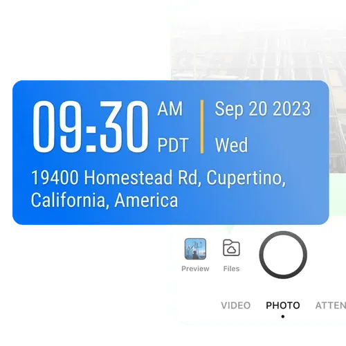
Auto-Tag Photos
Every photo you take gets stamped with the exact time and GPS photo location instantly. Unlike using a regular phone camera, you don't have to dig through metadata or enter info manually.
- GPS and timestamp data are tamper-proof, even if system time or GPS is manipulated.
- Switch on to add more context such as latitude, longitude, weather, elevation, compass direction, etc.
- Built-in verification via a unique photo code ensures every record is authentic and traceable.
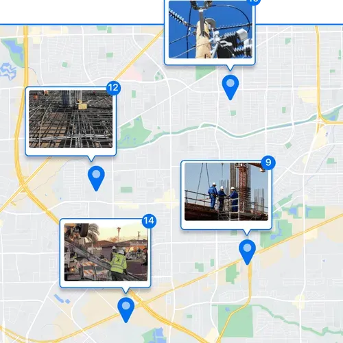
View on a Map
See every photo on a map to understand where work happened. Perfect for remote progress checks or multi-site projects.
- Zoom in to examine specific areas or zoom out to view the overall site status at a glance.
- Quickly spot gaps in documentation or track progress remotely.
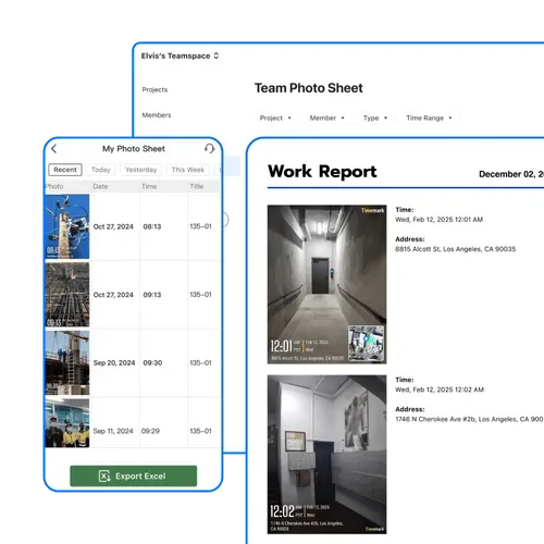
Quick Professional Reports
Turn your organized, location-tagged photos into professional reports in minutes. Less admin stress, more time for real work.
- Export all GPS photo locations, timestamps, and notes in one file.
- Sort or filter by project, date, or other job details in Excel for fast analysis.
- Keep verifiable proof of work ready to share with clients or management.
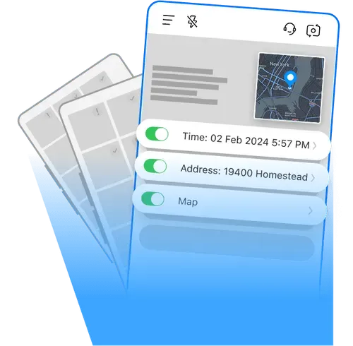
Share a Live Photo Link
Get a live gallery link to your photos and share it with your team. No downloads, no attachments, just instant access.
- View the exact address along other context of each photo in the gallery.
- Combine visual data and written context to streamline documentation.
- Get the answer to "where was this photo taken?" immediately.
How to Find a Photos' GPS Location?
1. Get Timemark App
Go to app stores, find Timemark and download it. Open the app, grant camera and location permissions.
2. Take Geotagged Photos
Open Timemark's camera, snap your field photo. It auto adds GPS and timestamp.
3. Share Photos
Easily share or export your photos. Each photo's GPS location is included, letting your team check exactly where it was taken.
Timemark vs Other Photo Tools
Timemark's Advantages
System Camera doesn't add GPS directly to photos. Timemark auto-tags GPS and time, making it great for field work proof. System Camera also can't organize team photos by project, but Timemark does it automatically.
vs GPS Map Camera
GPS Map Camera has no centralized storage. Photos are messy across devices, but Timemark stores all team photos in one place for easy access. Timemark also organizes photos by member while GPS Map Camera can't do that.
CompanyCam has no Map View. You can't see photos on a map to track sites, but Timemark's Map View shows photos on maps for easy progress checks. Timemark also offers Excel View for address checks.
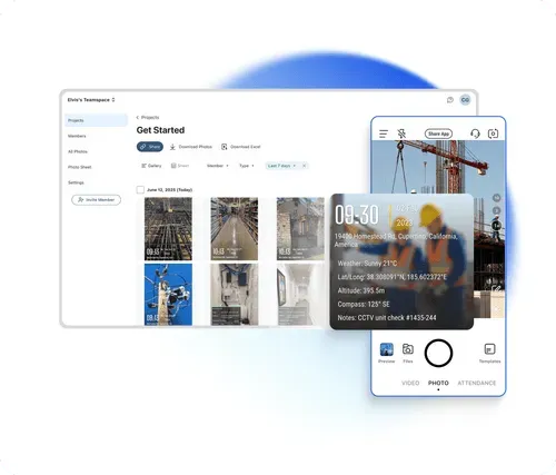
Want to Organize Job Photos Smarter?
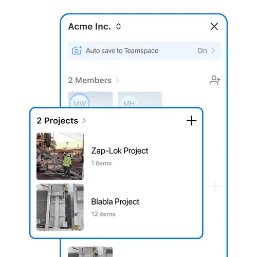
Timemark goes beyond showing a photo's GPS location. It helps your team manage every project image in one place. With Teamspace, field photos are automatically grouped by project, date, and member, making it the best solution for tracking and collaboration.
Get Started FreeFrequently Asked Questions

Track Every Photo with GPS Photo Location
Download Timemark free to automatically add GPS photo location to every picture, auto-sort field photos, and get clear proof of where each photo was taken. Protect your work and never ask "where was this photo taken" again.
Start For Free