
GPS Map Camera for Work Photos: Who Needs It & Why
Hesper Du
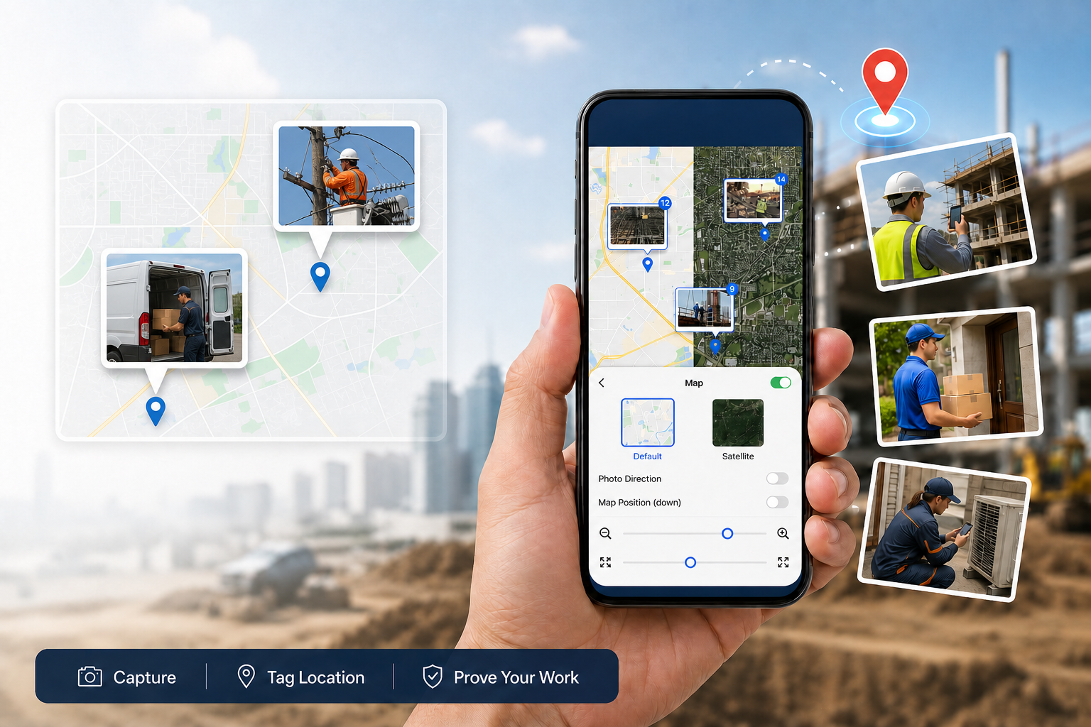
GPS Map Camera helps field teams record the time, location, and context of a work photo while it is taken. Use it when a photo needs to be clear to a manager, client, or teammate who was not on site.
Geotagging, Geotagged Photos, and GPS Map Camera
Geotagging is the process of recording a photo's location. A geotagged photo is the resulting photo with GPS information, usually stored in its metadata.
A GPS Map Camera is a type of camera app that records location when the photo is taken and can show the date, time, address, coordinates, or map directly on the image. For field teams, this makes a work record easier to review without opening photo metadata.
Who Needs GPS Map Camera?
Construction teams
Projects move through stages and may run across several sites at once. GPS and time information help teams align progress photos with the right site and stage, so handover and acceptance checks take less back-and-forth.
Explore Timemark for construction teams: https://www.timemark.com/industries/construction
Field inspection teams
An inspection finding is more useful when everyone can identify the exact location where it was recorded. Geotagged photos help teams connect an issue, follow-up work, and the inspection point.
Installation, maintenance, and field-service teams
Crew members can visit several customer locations in one day. Location data helps link a work photo to the service visit, so managers and customers can quickly understand where the work was carried out.
Property and facilities teams
When a team manages many buildings, stores, or assets, location data keeps inspection, damage, and repair photos connected to the right property over time.
Telecom and infrastructure teams
Different members of the same crew may work at separate base stations, lines, or equipment sites. GPS information makes it easier for managers to see which location each photo belongs to and keep distributed work aligned.
Explore Timemark for telecom teams: https://www.timemark.com/industries/telecom
Delivery and on-site handover teams
A location-tagged photo gives an important delivery or handover record clear context, making internal checks and later dispute handling easier.
Explore Timemark for logistics teams: https://www.timemark.com/industries/logistics
What Should a Work Photo Record?
For most teams, a useful work photo should make five things clear: where it was taken, when it was taken, what it shows, which project or customer it belongs to, and how it can be found later.
A photo that only stores GPS metadata can be enough for personal use. Field teams often need the time and location to be visible, plus a way to organize photos by project, task, or team member.
Choosing a GPS Map Camera for a Team
Choose a tool that records information while the photo is taken, shows location in a format your reviewers can understand, and lets the team organize photos by project or task. If photos support client reporting, acceptance, or compliance, look for photo verification and report-generation features too.
A Simple Workflow for Field Photos
Capture a photo at a key arrival, progress, issue, or completion point. Record time and GPS location automatically. File the photo under the relevant project, customer, or task. Let managers review photos and create a report when needed.
Record Work Photos with Timemark
Timemark helps field teams capture work photos with timestamps and GPS location, organize them by project, verify records, and turn them into reports. It is built for teams that need more than a location-tagged image: they need a usable record of field work.
Frequently Asked Questions
CONSTRUCTION
Field Photo Workflow for Construction
Keep progress, inspection, and handover photos tied to the right jobsite.
Explore Construction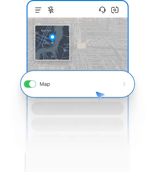
TELECOM
Telecom Field Photo Workflows
Keep distributed crews, site photos, and project reporting aligned.
Explore Telecom
LOGISTICS
Photo Records for Logistics Teams
Give delivery and handover photos clear location and project context.
Explore Logistics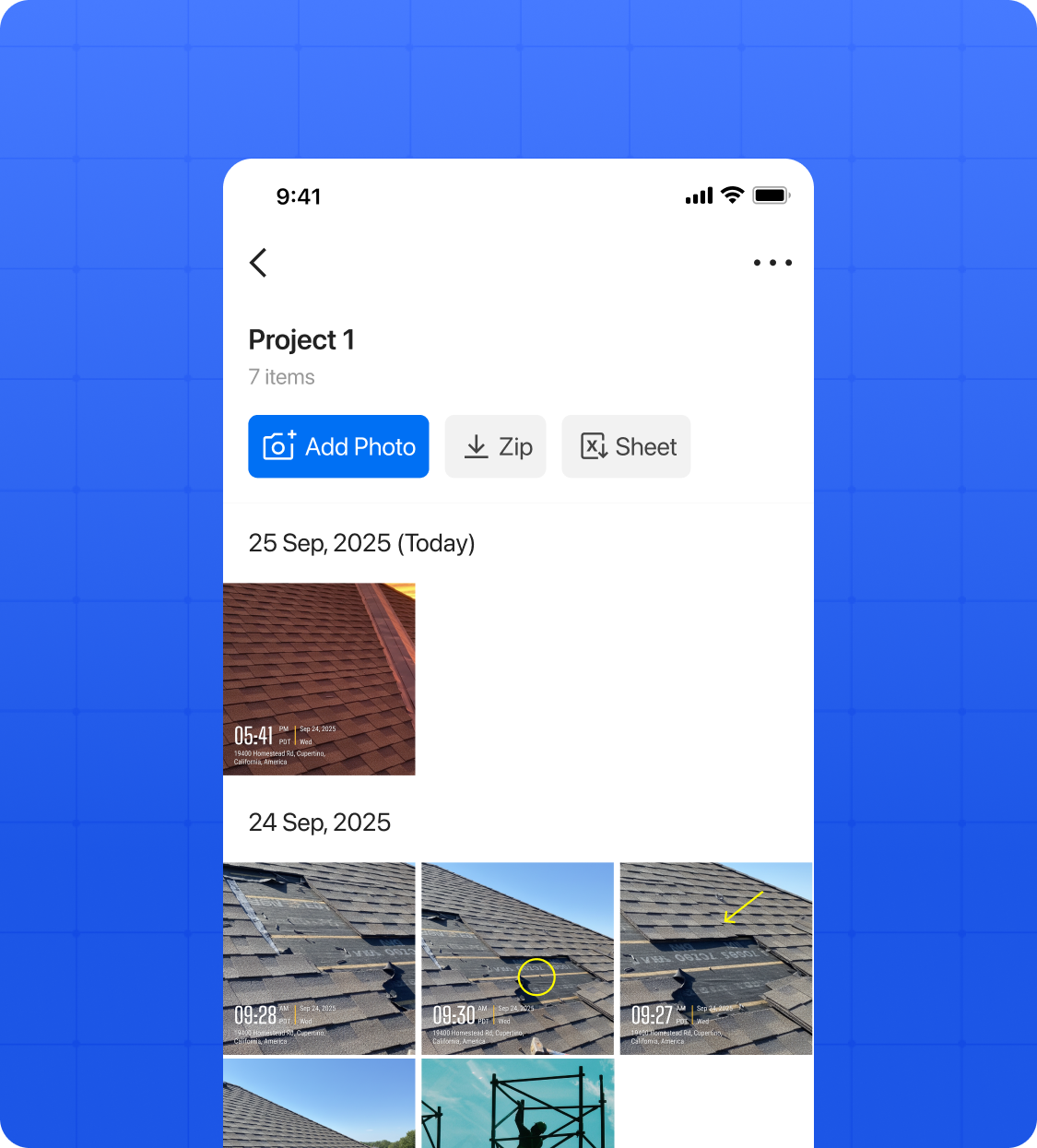
About Timemark
Timemark helps field teams capture work photos with timestamps and GPS location, organize them by project, verify records, and turn photos into clear reports. It is built for teams that need a dependable field record, not just a photo with a location tag.
Explore Timemark GPS Camera for work photos.